NASA spots Eastern Pacific season's earliest first tropical storm in satellite era

The first tropical storm in the Eastern Pacific Ocean has formed west of Costa Rica as NASA-NOAA's Suomi NPP Satellite passed overhead. Tropical Storm Adrian's formation has already made a mark in hurricane history.
Although Eastern Pacific hurricane season doesn't start officially until May 15, it's just a marker. We've already seen the first tropical storm in the Atlantic Ocean form in early May. In the Eastern Pacific Ocean, that's unusual. The first Eastern Pacific Ocean tropical cyclone formed on Tuesday, May 9 around 4 p.m. EDT when the National Hurricane Center designated Tropical Depression 1E at about 335 miles (540 km) south-southwest of San Salvador, El Salvador
Forecaster Stewart of NOAA's National Hurricane Center noted that when the depression strengthened into the first tropical storm of the season, it became the earliest tropical storm to ever form during the satellite era.
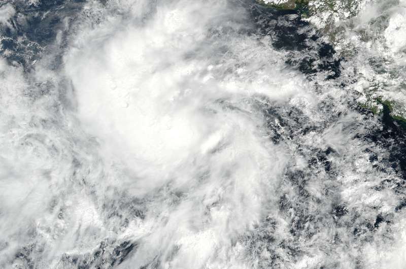
On May 9 at 19:12 UTC 3:12 p.m. EDT) the Visible Infrared Imaging Radiometer Suite (VIIRS) instrument aboard the NASA-NOAA Suomi NPP satellite captured a visible light image of Tropical Depression 1E off the western coast of Central America. Strong thunderstorms appeared tightly wrapped around the center of circulation and in a thick band wrapping into the center from the north.
At 5 a.m. EDT (0900 UTC) on May 10 the center of Tropical Storm Adrian was located near latitude 10.0 north and longitude 92.7 west. That's about 460 miles (740 km) south-southeast of Salina Cruz, Mexico. Maximum sustained winds were near 45 mph (75 kph) with higher gusts, and the National Hurricane Center noted that some strengthening is forecast during the next 48 hours. The estimated minimum central pressure is 1004 millibars.
Adrian was moving toward the northwest near 7 mph (11 kph), and this general motion is expected during the next couple of days.
Adrian is moving over warm waters and the shear is low, gradual strengthening is still forecast. Adrian is expected to move west-northwest and turn to the north where it is forecast to approach the Gulf of Tehuantepec after 5 days.
For updated forecasts, visit the NHC website: http://www.nhc.noaa.gov.
Provided by NASA's Goddard Space Flight Center


