NASA looks at major Hurricane Matthew's winds, clouds

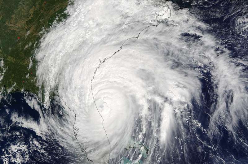
As Hurricane Matthew continues to crawl along the southeastern U.S. coast NASA observed the storm's winds, clouds, precipitation and more. Matthew remained a major hurricane on Friday, Oct. 7 at 2 p.m. EDT.
On Oct. 6, NASA's CloudSat passed over the eastern quadrant of Hurricane Matthew at 2:30 p.m. EDT. CloudSat revealed the anvil (thick cirrus cloud cover) with cumulus and cumulonimbus clouds beneath the cirrus. CloudSat found areas of higher reflectivity that included larger water and/or ice droplets throughout the clouds.
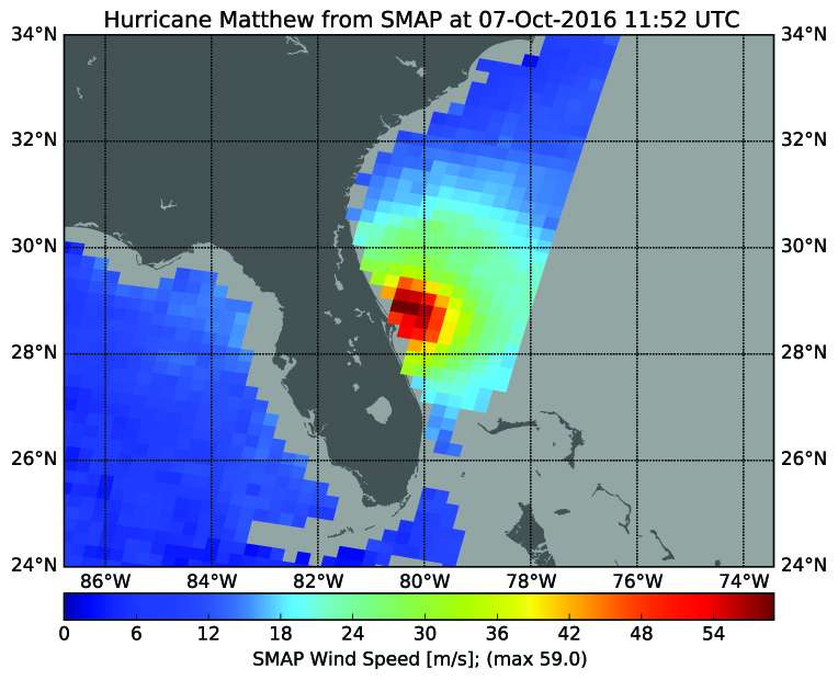
The next day, NASA's Soil Moisture Active Passive (SMAP) satellite observatory captured data on Matthew's winds. SMAP observations of hurricane Matthew showed winds up to 132 mph (59 meters per second/212 kph) at 7:52 a.m. EDT (11:52 UTC) on Oct. 7. "SMAP has excellent sensitivity to extreme winds, far beyond that from typical scatterometers," said Alexander Fore, of NASA's Jet Propulsion Laboratory in Pasadena, California. "SMAP is sensitive to these extreme winds due to the use of the L-band passive brightness temperature observation, which has the additional benefit of not being attenuated by rain giving accurate wind speeds regardless of rain conditions."
SMAP will map global soil moisture and detect whether soils are frozen or thawed. The mission will help scientists understand the links between Earth's water, energy and carbon cycles; help reduce uncertainties in predicting weather and climate; and enhance our ability to monitor and predict natural hazards such as floods and droughts.

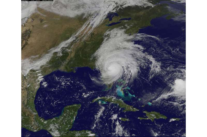
At 2:30 p.m. EDT a visible image from NOAA's GOES-East satellite showed Matthew's clouds engulfing almost all of Florida, Georgia and the Carolinas. The image was created by the NASA/NOAA GOES Project at NASA's Goddard Space Flight Center, Greenbelt, Maryland.
At that time a Hurricane Warning was in effect for Cocoa Beach to Surf City. A Hurricane Watch is in effect from north of Surf City to Cape Lookout, North Carolina. A Tropical Storm Warning was in effect from Florida's Sebastian Inlet to Cocoa Beach, and north of Surf City to Duck, North Carolina, and the Pamlico and Albemarle Sounds, North Carolina.
At 2 p.m. EDT (1800 UTC) on Oct. 7, Matthew remained a Category 3 Hurricane on the Saffir-Simpson Hurricane Wind Scale. The eye of Hurricane Matthew was located near latitude 29.7 North, longitude 80.7 West. That's about 40 miles (60 km) east-southeast of St. Augustine, Florida.
NOAA's National Hurricane Center (NHC) said Matthew is moving toward the north-northwest near 13 mph (20 km/h), and this general motion is expected to continue today. A turn toward the north is expected tonight or Saturday, Oct. 8. On the forecast track, the center of Matthew will continue to move near or over the coast of northeast Florida and Georgia through tonight, and near or over the coast of South Carolina on Saturday.

Maximum sustained winds are near 115 mph (185 kph) with higher gusts. Matthew is a category 3 hurricane on the Saffir-Simpson Hurricane Wind Scale. Although weakening is forecast during the next 48 hours, Matthew is expected to remain a hurricane until it begins to move away from the United States on Sunday.
Hurricane-force winds extend outward up to 60 miles (95 km) from the center and tropical-storm-force winds extend outward up to 185 miles (295 km). The latest minimum central pressure reported by an Air Force Hurricane Hunter plane was 947 millibars.
A wind gust to 84 mph (135 kph) was recently reported at Ponte Vedra, and a coastal marine observing station at St. Augustine recently measured a wind gust of 85 mph (137 kph). A tidal gauge at Fernandina Beach, Florida reported a storm surge inundation of 3.11 feet above mean higher high water.
For updated forecasts, please visit the National Hurricane Center website: http://www.nhc.noaa.gov.
Provided by NASA's Goddard Space Flight Center


